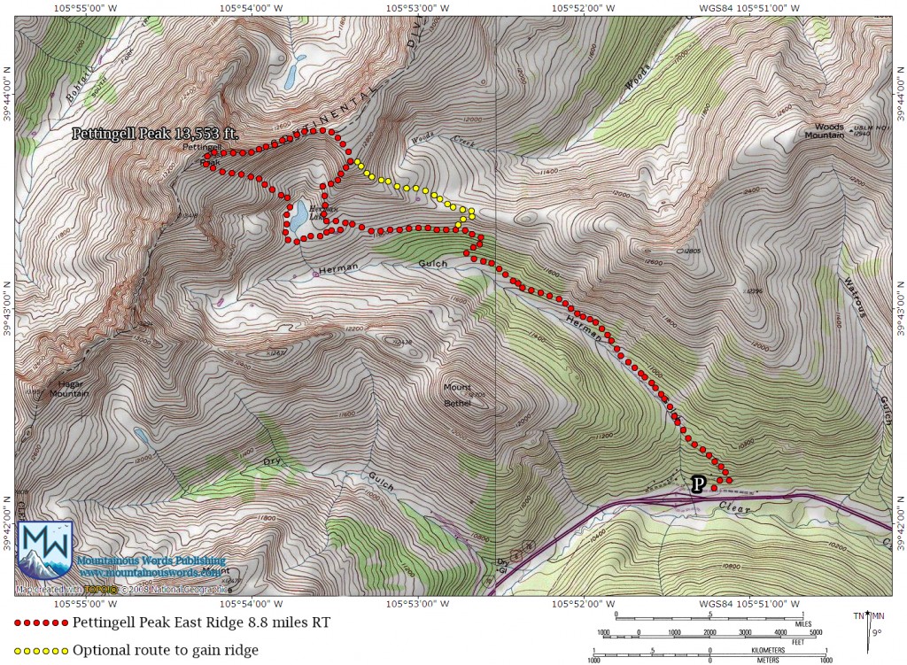
Pettingell Peak’s east ridge is a scrambler’s delight, consisting of relatively solid class 3 rock. Only an hour’s drive from Denver to the trailhead, this overlooked route not only tops out on a 13er, Pettingell Peak is also the highest point of Grand County. For a more colorful write-up & photos, check out the Pettingell Peak trip report.
| Round Trip Distance: 8.8 miles Hiking Time: 6 – 8 hours Difficulty: Class 3 with Off Trail Navigation |
Start Elevation: 10,319 ft. at Herman Gulch TH Summit Elevation: Pettingell Peak 13,553 ft. Crowd Level: Low |
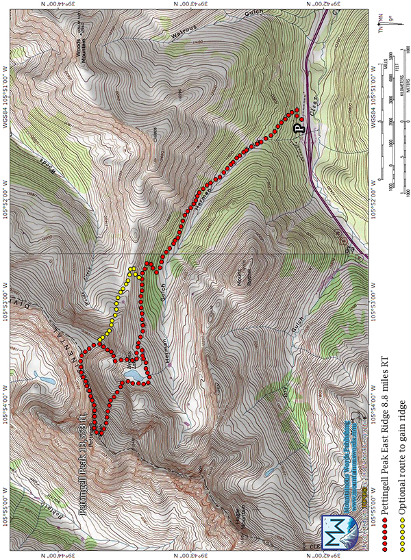
For full sized map, see bottom of guide below.
Directions
From either direction on I-70, take exit 218. If coming westbound, go right at the exit ramp and immediately take your first right to the Herman Gulch trailhead parking. If coming eastbound, turn left off the exit and proceed under I-70 to the parking lot. This parking lot is a couple hundred feet from the exit.
Fees/Camping
There are no fees to hike. No camp sites are provided but overnight parking is allowed.
Hike Direction and Notes
Herman Gulch is an extremely popular area for day hikers due to its close proximity to Denver/Boulder/Golden and is only about an hour’s drive from most metro locations. Most people come to hike to Herman Lake, thus Pettingell Peak sees few visitors (there is no trail to the top). The east ridge scramble sees even fewer ascents. This is a great scramble for those new to ridge climbs or hikers wanting to try a more challenging line to the summit as opposed to the walk up the south slopes.
From the trailhead, start on the Herman Gulch trail and take a left at the nearby sign at the juncture towards Herman Lake. You’ll be cruising on this well worn trail for roughly 3 miles as it ascends through beautiful meadows. Your initial goal is to gain the ridge to your right (north). At about 2.3 miles, there is the option to bushwack through light woods and gain a saddle at 11,900 ft. that makes getting on the ridge a class 2 endeavor. This is indicated by the optional yellow dotted lines on the map. For a scramble to gain the ridge, go 3 miles and just before Herman Lake ascend a moderate hill that turns into a class 3 scramble along a broken arete. The rock here is loose but with a little testing can be easily climbed. Angling off to the left near the summit will gain the ridge with a slightly easier scramble.
Either way, once you’ve gained the mellow ridge you’ll drop down into a saddle at 12,800 ft. that signals the start of the real scramble. At first the line along Pettingell looks daunting. Even though it is only 0.7 miles, check the weather before committing to the line. It can take about 2 hours with the route finding. For the first half of the scramble, the obstacles on the ridge proper can be avoided by taking a welcome series of grassy, relatively solid ledges on the left (south) side of the ridge. A series of notches along the way require a bit of downclimbing but most of these moves are easy. Lingering snow patches may be present until early July so microspikes or crampons may be a good idea for a spring ascent (summer ascents won’t need them). Continuing picking away along the ridge until you see the looming fin of rock blocking the way to the summit. At roughly 13,000 ft. there will be scrambling options on the north side of the ridge now and staying on the ridge proper to the base of the fin is possible, with perhaps a class 4 move here or there. Keep it class 3 by skirting the ridge on whatever side you are most comfortable. At this point, both sides have possibilities.
As you get to the base of the fin at 13,200 ft. the terrain finally reveals itself to be relatively moderate. An airy 3+ scramble on the ridge proper can ascend the fin while an easy-to-navigate class 3 side option to the left (south) is a little less exposed. Atop the fin, it’s an easy class 2 walk 0.1 miles to the top. The 13,553 ft. summit of Pettingell is a delight with fantastic views in all directions and has a well-built wind shelter. It is also the highest point of Grand County, Colorado.
Descent via the south slopes can be a very fun glissade if you brought your ice axe. When looking from the summit, aim to the basin/snowfield on the right for the most moderate slopes. Note that there is no trail. Once you’ve dropped down to 12,200 ft. aim left to find a welcome grassy gully that avoids downclimbing cliffs to Herman Lake. Skirt the lake, regain the main trail and head for home!
Photos & Larger Map
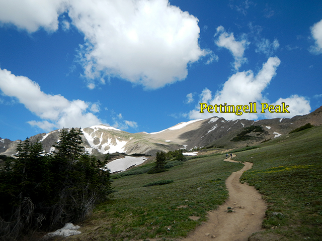
From the trail, Pettingell Peak cuts a rather dull profile. Don’t worry, the fun is yet to come.
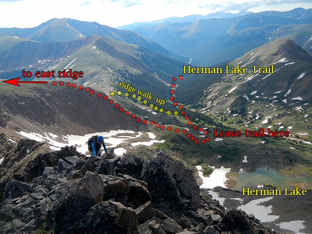
Taken from the fin, this photo shows the scramble to gain the ridge (red) and the optional walk up to the ridge (yellow).
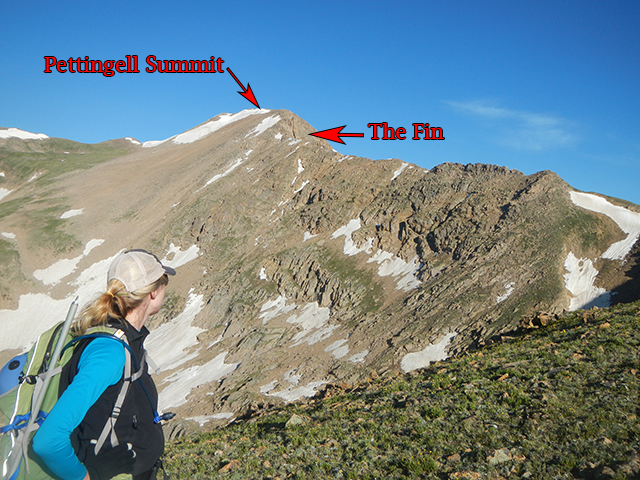
Once you’ve gained the ridge, the line to the summit looks a bit daunting.
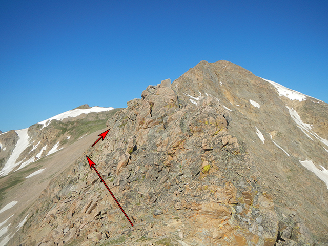
At the “start notch”, go left for the easiest line.
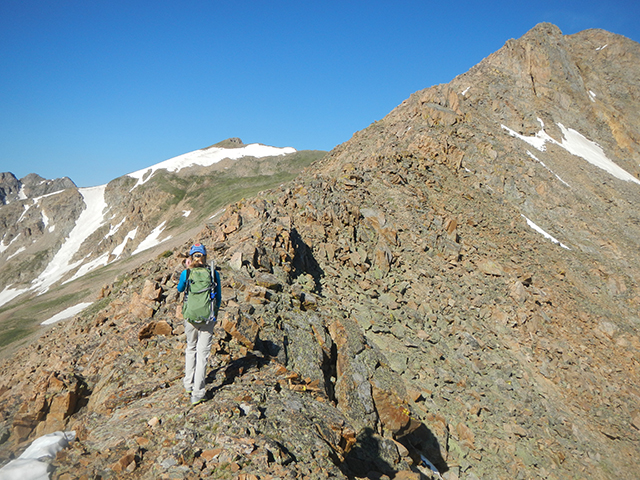
Halfway through, the route finding gets easier and up close, the foreboding fin reveals itself to have several easy class 3 options to ascend.
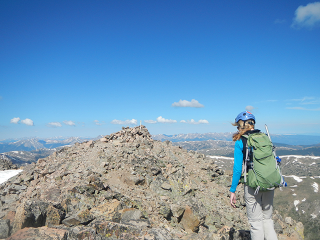
After clearing the fin, the walk to the summit is a breeze.
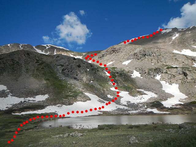
Looking down from the summit, you will see left and right slope options. Aim skier’s right (where a big snowfield will likely be) and then scout out the notch shown above to reach the lake without any cliff issues.

