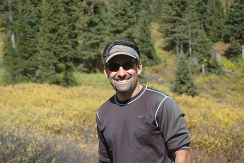
Last Updated on January 8, 2014 by James Dziezynski

Mount Alice 360 degree view. Click for larger image.
Download the free Mount Alice & Tanima Peak guide!
Though it was getting late in the season, my buddy Kyle was on a mission: to climb 13,310 ft. Mount Alice in Rocky Mountain National Park. He had been thwarted on two previous attempts due to such unforeseen circumstances as climbing the wrong peak (neighboring Chiefs Head, oops!) Alice is a long day so we decided, what the heck let’s make it longer by tacking on 12,420 ft. Tanima Peak and making a humungo 17.2-mile loop via Boulder Grand Pass. We recruited Belgian strong man/beer expert Bart and set off on October 23, 2011 on a picture perfect autumn Colorado day.

A look at the 17.2 mile round trip adventure to Mount Alice and Tanima Peak via Lion Lakes and returning by Boulder Grand Pass and Thunder Lake.
The above map shows our route and here’s the elevation profile.

The 5,000 ft. plus elevation day is good for the legs and the lungs!
The approaches to Mount Alice are long but quite fast. The 5.7 mile trail to the start of the Lion Lakes can be reached in about 2.5 hours at a strong pace. Navigating through the lakes is relatively easy and the scenery in Wild Basin is flat out amazing.

Bart gets his first glance at Mount Alice's sort of famous east face, known by some as the "Mini-Diamond" in homage to the Diamond on nearby Longs Peak. Some prefer to call it the cubic zirconium.

The boys grab a bite at Snowbank Lake just below Hourglass Ridge.
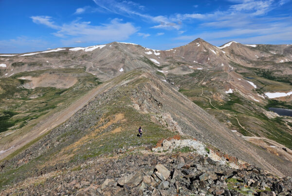
Since we were doing a lollipop loop, the best way to get up Mount Alice is the class 3 route that follows Hourglass Ridge. There is an established trail to Lion Lakes that fades out, meaning a good chunk of the navigation is off-trail, though the ridgelines are fairly obvious. Hourglass Ridge connects with a saddle between Chiefs Head and Alice and an ambitious hiker could snag both peaks in a day if they felt so inclined.

The Ptarmigan is one of Colorado's masters of disguise. Can you find him in this picture?

Kyle in red and Bart in black at the start of Hourglass Ridge.

A good look at the Mini Diamond on the east face of Mount Alice.

Kyle navigates a small notch on the way up Mount Alice's north ridge.

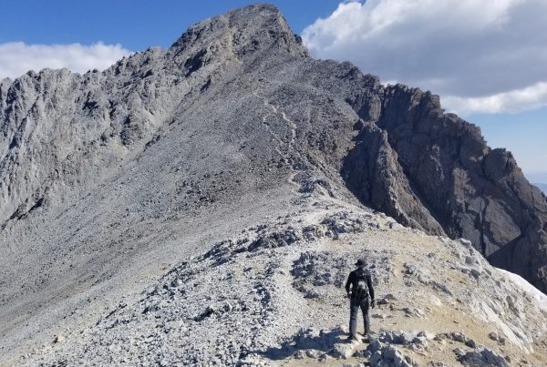
Kyle at the base of the half mile scramble to the top.

Bartman gettin' it done on the way up Mount Alice.

The crew on the summit of Mount Alice. Not a cloud in the sky!

Tanima Peak is 900 feet lower than Alice but is a surprisingly fun summit with great views.

Kyle on the final push up to Tanima's summit with picture-perfect views of (left to right) Chiefs Head, Longs Peak, the Notch and Mount Meeker.

The final approach to Tanima had some surprising mini-moves.

Bart is king of Tanima Peak! This cool mushroom rock is the 12,420 ft. summit.

Kyle and Bart chillin' on Tanima.

I made it to the summit of Tanima Peak too!

A very cool look at the Moomaw Glacier (middle snowfield) on the shoulder of The Cleaver/Isolation Peak.

The red line shows our escape couloir, which for some reason Kyle refuses to follow. The gully was a little loose but safe and easy to scramble down.

Bart is making tracks just past the Lake of Many Winds as we bushwack towards Thunder Lake.

A look back at the route we took to bushwack from the top of Boulder Grand Pass to Thunder Lake, where a well worn trail would lead us home.
When we finally made it to the heavily used trail to Thunder Lake, it was just a matter of putting one foot in front of the other. Even at a fast pace, the entire journey took us 12 hours and the stars were out by the time we made it back to the Wild Basin parking lot. It was a spectacular day with perfect weather and I couldn’t have asked for better company.
Third time’s a charm, Kyle!

Bonus picture of our GPS tracks in Google Earth view. Neat-o!