Last Updated on October 31, 2015 by James Dziezynski

Mount Edwards options from Peru Creek Basin. Click for larger map.
Mount Edwards stands at 13,850 ft. making it Colorado’s 83rd highest mountain. It’s also one of my very favorite dog-friendly peaks! In April, Sheila I climbed Edwards’ north facing Goatfinger Couloir and I remarked that the Argentine Pass option looked like a fantastic place to take pals of both the human and canine variety. Even though Mount Edwards is a fairly straightforward adventure, there’s some spotty information online. I hope to get a decent page up in my hiking guides section soon. And for a future project: biking the Argentine Pass from Leavenworth Creek!

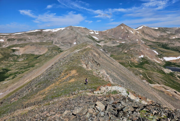
Fremont on the Argentine Pass Trail with stunning views of Grays Peak on the left and the flat dome of Mount Edwards on the right.
Argentine Pass is one of my favorite Front Range hiking trails. If you can ignore the power lines, there’s a lot to like: old mine ruins, beautiful wildflowers, a very well-made trail and the option to snag several peaks from the top of the pass. Besides Edwards, you can grab Grays, Torreys and Ruby Mountain to the west, Argentine Peak, Mount Wilcox and Decatur Mountain to the south or McClellan Mountain to the north. As a ridge-o-phile I love all the possibility.

The crew takes a break halfway up Argentine Pass. The road into Peru Creek Basin is easily seen from here.

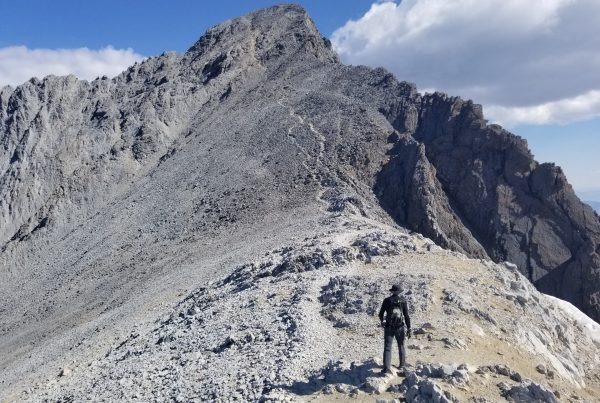
Paul pops out at the top of 13,200 ft. Argentine Pass!

Mystic looks ahead to the shoulder of Mount Edwards while Bart grabs a drink.

The ridge over to Edwards is broad and mellow.

The crew closes in on the summit!

Fremont tops out on Mount Edwards. I didn’t have the heart to tell him that’s the “Dead Dog” couloir on Torreys Peak behind him!

Mystic gets a glance at Steven’s Gulch and Kelso Mountain.

Milling about on the summit.
Crowds are very low at Mount Edwards, in fact there’s no established trail to the top (though it’s easy to follow the ridge to the summit). It’s quite a site to see rows of hikers sticking up like porcupine quills on Grays and Torreys when you will likely have Mount Edwards all to yourself.

Time to head down. 13,738 ft. Argentine Peak looms in the distance.

Leavenworth Creek basin from Mount Edwards.

Mystic and Sheila on a stormy day!
I’ve seen a few sites that list the “South Slopes” as a standard route. I’d highly advise against plodding up this route. Besides the fact Argentine Pass is a superior, wonderful class 2 trail, the south slopes look positively dreadful. Loose, steep and miserable. If you hate your knees though, give it a shot.

Need more of a challenge? Try the Goatfinger Couloir on the north side!
The 3.8 mile dirt road up to Peru Creek Basin is rough but passable by tough Subaru-type cars. Trucks will be fine. I’d highly suggest Mount Edwards for a close, fun day hike and tack on the extra summits for more challenge!